
Multilateral conflict analytics and sophisticated engineering resolutions to integrate utility infrastructure within mainline transportation projects to effectively reduce risk and the project schedule critical path. We have a state-of-the-art utility conflict management module for enabling superior utility engineering analytics and project delivery optimization strategies.
Archives: Services
Service Description
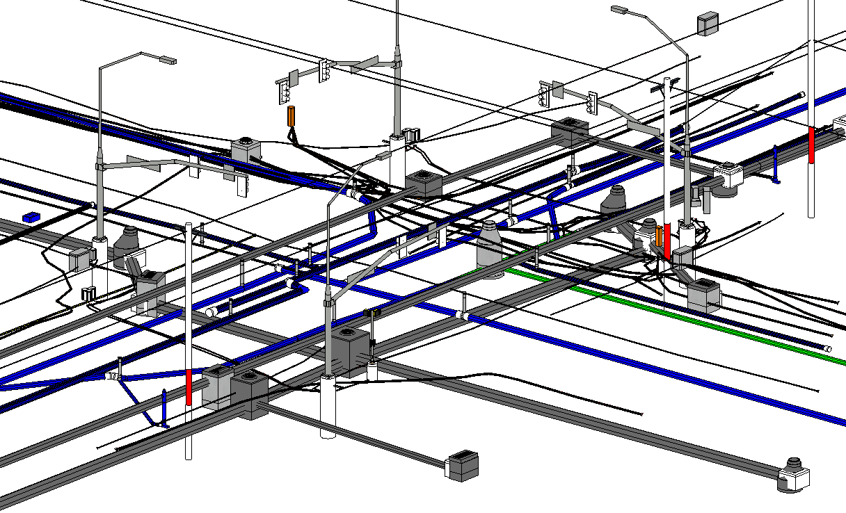
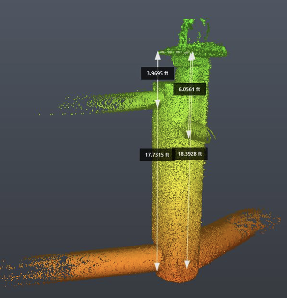
BIM (Building Information Modeling)
Accurate and reliable 3D models lead to a better understanding of conflicts between utility infrastructure and civil projects. Equipped with that knowledge, project owners, designers, utility and facility operators, and contractors can plan accordingly and find resolutions to those conflicts before construction begins.
Lacus ornare orci at mattis et.
- Investigating, depicting, and mapping utilities in accordance with ASCE 38/75 standards; Documenting facility condition and notifying concerned parties;
- Processing and managing utility data using OGC compliant, GIS friendly technologies;
- Analyzing and resolving issues while building relations through professional utility engineering whereby the public welfare is held paramount over all other interests;
- Engaging stakeholders (e.g., project owners, design team, utility operators, public and commercial interests) while coordinating the resolution process;
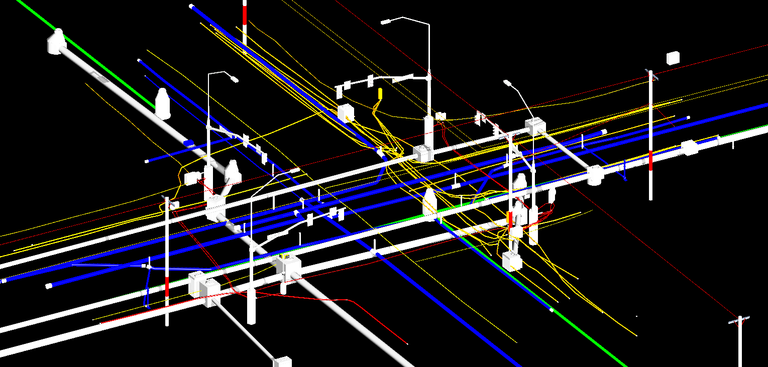
Construction
Accurate and reliable 3D models lead to a better understanding of conflicts between utility infrastructure and civil projects. Equipped with that knowledge, project owners, designers, utility and facility operators, and contractors can plan accordingly and find resolutions to those conflicts before construction begins.
Lacus ornare orci at mattis et.
- Investigating, depicting, and mapping utilities in accordance with ASCE 38/75 standards; Documenting facility condition and notifying concerned parties;
- Processing and managing utility data using OGC compliant, GIS friendly technologies;
- Analyzing and resolving issues while building relations through professional utility engineering whereby the public welfare is held paramount over all other interests;
- Engaging stakeholders (e.g., project owners, design team, utility operators, public and commercial interests) while coordinating the resolution process.
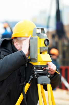
Land Surveying
Accurate and reliable 3D models lead to a better understanding of conflicts between utility infrastructure and civil projects. Equipped with that knowledge, project owners, designers, utility and facility operators, and contractors can plan accordingly and find resolutions to those conflicts before construction begins.
Lacus ornare orci at mattis et.
- Investigating, depicting, and mapping utilities in accordance with ASCE 38/75 standards; Documenting facility condition and notifying concerned parties;
- Processing and managing utility data using OGC compliant, GIS friendly technologies;
- Analyzing and resolving issues while building relations through professional utility engineering whereby the public welfare is held paramount over all other interests;
- Engaging stakeholders (e.g., project owners, design team, utility operators, public and commercial interests) while coordinating the resolution process;
Hydrographic Surveying
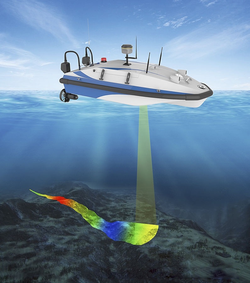
Accurate and reliable 3D models lead to a better understanding of conflicts between utility infrastructure and civil projects. Equipped with that knowledge, project owners, designers, utility and facility operators, and contractors can plan accordingly and find resolutions to those conflicts before construction begins.
Lacus ornare orci at mattis et.
- Investigating, depicting, and mapping utilities in accordance with ASCE 38/75 standards; Documenting facility condition and notifying concerned parties;
- Processing and managing utility data using OGC compliant, GIS friendly technologies;
- Analyzing and resolving issues while building relations through professional utility engineering whereby the public welfare is held paramount over all other interests;
- Engaging stakeholders (e.g., project owners, design team, utility operators, public and commercial interests) while coordinating the resolution process;
Geospatial Services & Solutions

Accurate and reliable 3D models lead to a better understanding of conflicts between utility infrastructure and civil projects. Equipped with that knowledge, project owners, designers, utility and facility operators, and contractors can plan accordingly and find resolutions to those conflicts before construction begins.
Lacus ornare orci at mattis et.
- Investigating, depicting, and mapping utilities in accordance with ASCE 38/75 standards; Documenting facility condition and notifying concerned parties;
- Processing and managing utility data using OGC compliant, GIS friendly technologies;
- Analyzing and resolving issues while building relations through professional utility engineering whereby the public welfare is held paramount over all other interests;
- Engaging stakeholders (e.g., project owners, design team, utility operators, public and commercial interests) while coordinating the resolution process;
Engineered Solutions
Accurate and reliable 3D models lead to a better understanding of conflicts between utility infrastructure and civil projects. Equipped with that knowledge, project owners, designers, utility and facility operators, and contractors can plan accordingly and find resolutions to those conflicts before construction begins.
Multilateral conflict analytics and sophisticated engineering resolutions to integrate utility infrastructure within mainline transportation projects to effectively reduce risk and the project schedule critical path. We have a state-of-the-art utility conflict management module for enabling superior utility engineering analytics and project delivery optimization strategies.