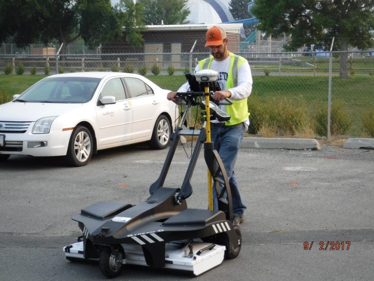
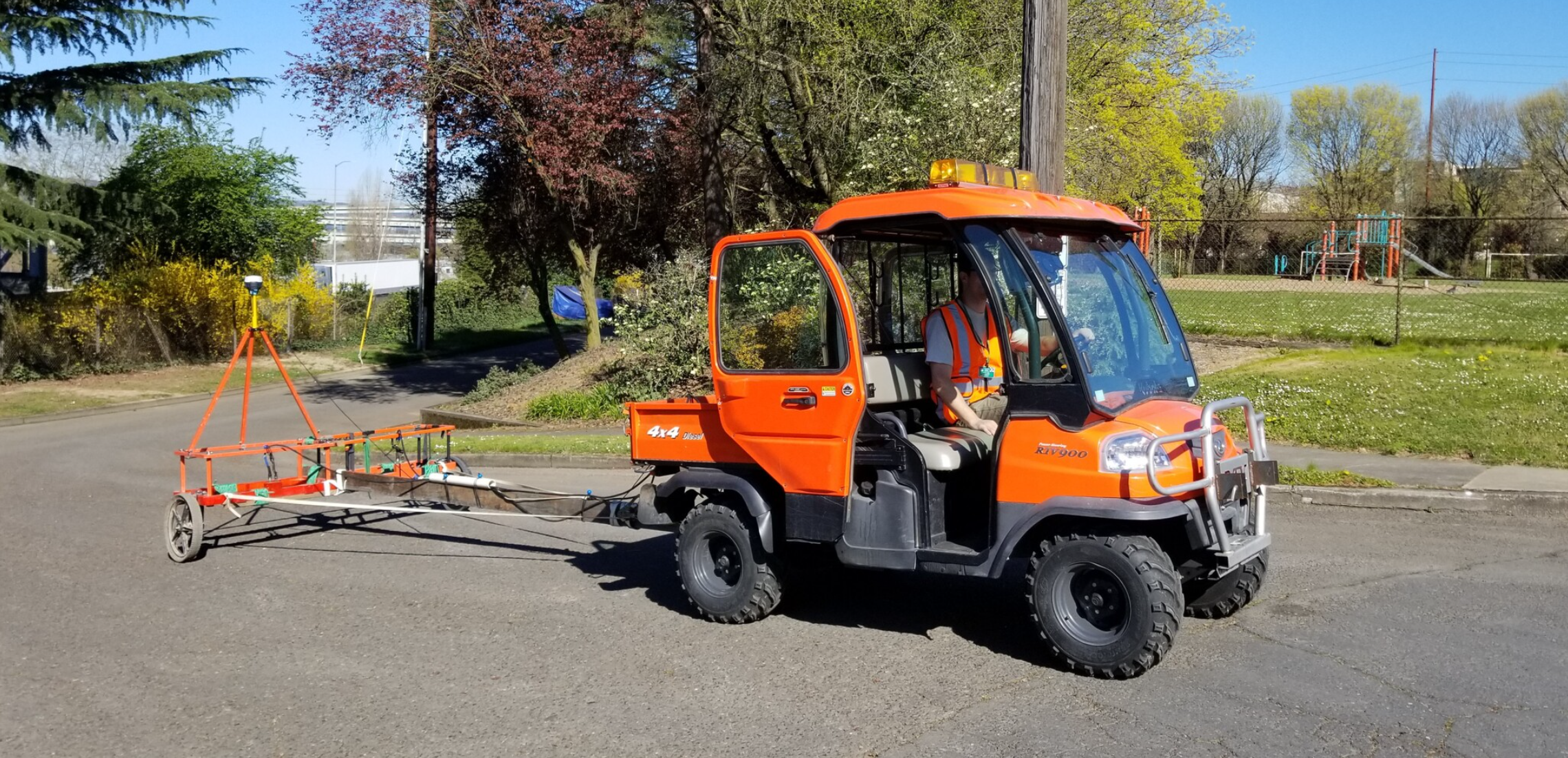
Stream C is the compact array solution for real-time 3D mapping of underground utilities and features. Thanks to the increased level of accuracy, provided by a massive antenna array, Stream C is able to detect pipes and cables automatically.
Daily use of Stream C is aided by ergonomic features including electronic ride height adjustment, options to tow manually or with a small vehicle, and a motor assisted drive wheel. Our Stream C is available in both Basic and Advanced configurations.
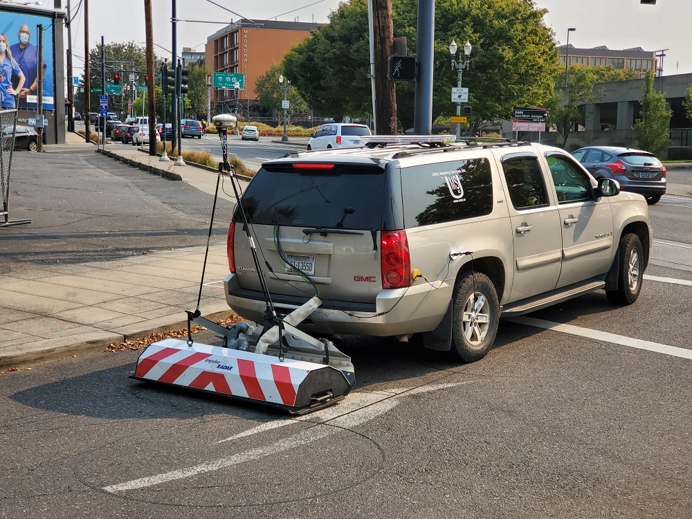
UMS has acquired and successfully deployed the Raptor®, the newly Federal Communications Commission certified high-speed ground penetrating radar (GPR) array manufactured by Impulse Radar AB in Sweden. The system is the first GPR array to incorporate real-time digital sampling technology that allows the collection of 3D GPR data at posted highway speeds. The advanced digital technology provides increased depth penetration in most soils and a large bandwidth facilitates greater resolution of utility and other targets.
FEATURES
- Collect data at posted highway speeds in most areas
- High-resolution, dense 3D data coverage
- Positioning to survey grade
- Utility and other features are directly mapped to CAD software
BENEFITS
- Reduces project data collection costs and time
- No lane closures or traffic control for most projects
- Augments all sensor data for SUE investigations over large areas not practical with 2D GPR systems
- Provides higher quality dense data to detect more underground facilities and other buried objects
The G-858 MagMapper is a high sensitivity, fast-sampling ‘walking’ magnetometer. Its console includes a graphical interface that makes survey design and data review simple and efficient. The G-858 provides various modes of operation to allow users to custom design a survey grid for their particular needs. Instrument operators have the ability to view their position on the grid and the current data profile during the survey. Display resolution, audible alerts, sample rate and many other functions are user selectable.
G-858 data acquisition offers either continuous or discrete station recording. The high sampling rate of the instrument in continuous mode allows the operator to survey an area at a fast walking pace. A wider search zone can be achieved by adding a second sensor. Adding a second sensor also provides the ability to measure the magnetic field gradient.
The G-858 is designed to interface easily with standard computers and peripherals. Geometrics encourages clients to provide their own processing computer hardware.
Geonics Metal Detectors are high power, high sensitivity metal detectors suitable for applications in the detection of both ferrous and non-ferrous metal. Insensitive to common sources of both geologic and cultural noise, Metal Detectors can be operated without compromise to data quality in most survey environments.
Common applications, in several fields of geophysical practice, include the detection of environmental hazards (e.g. drums, underground storage tanks (USTs)); utilities and infrastructure; construction and industrial waste; and unexploded ordnance (UXO).
EM-61-MK2 recognized as a standard sensor technology within the environmental and military communities, the EM61-MK2A provides a maximum depth of detection of 5.5 m, depending on target characteristics.
The ML-1 is one of SSI’s longest-enduring and popular products for magnetic detection. This tool can be used to find corner markers (iron or steel), well casings, steel drums or septic tank handles, etc.
The ML series offers simple one-handed operation with an easy-to-learn keypad featuring only three buttons – no menus or cumbersome instructions to follow. The audio unit has the volume built into the on/off key; just hold down the key while it cycles through the settings. The ML-1 features strong monotube construction, providing structural integrity.
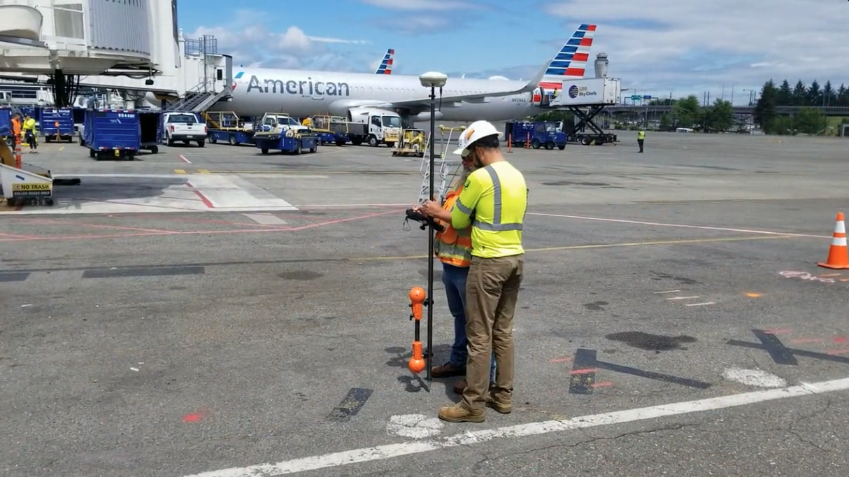
Our LiDAR equipment is a versatile technology adaptable to any environment, especially complex and enclosed spaces, without GPS signal. The 100Hz surveying system includes scanner, data logger and accessories – all that is needed to accurately scan and capture data.
UMS often needs to gather utility position information in hazardous complex and difficult to access spaces. Often there is limited or no GPS coverage (such as in manholes). Often we have a very limited time on site to accurately create a 3D model of those utility facilities, i.e. manholes within a busy thoroughfare. Access to this user-friendly technology that can quickly scan multi-level environments and produce accurate and high quality data is a game-changer for UMS.
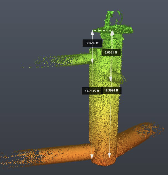
Through use of a model-based solution, the SPAR 300 computes an estimated 3-D coordinate (horizontal and vertical position which is tied to the project survey control) on targeted underground utilities and qualifies each discrete observation with a derived “accuracy” metric that is based on the apparent circularity of the observed magnetic field.
A computed RMS (root-mean-square) between the fitted model solution and the observed magnetic field provides the reported SPAR 300 “accuracies” which are categorized as “VA, VB, VC, VD and VE”. Note: these are simply arbitrary measures of data confidence based on empirical methods and are not to be confused with Subsurface Utility Engineering (SUE) Standard (CI/ASCE 38-02) quality levels A-D which are professionally judged reliability designations.
RD8100® cable locator is engineered to deliver high precision for damage prevention when locating buried cables and pipes. This advanced range of underground utility locators offers optional integrated GPS and usage logging.
With utility infrastructures becoming more complex, locate professionals require more powerful, flexible tools. Features such as Current Direction and iLOC™ on the cable locator combine with the versatile Tx Transmitter range to deliver high-precision locates even in tough conditions
Integrated GPS and usage-logging options automatically generate data for customer reports, or in-house quality and safety audits to promote best working practices.The RD Map app for Android is a real time map and share tool that creates maps of buried utilities, while the RD Manager PC program provides a suite of useful tools to the user such as installing the latest software for their locator and remotely certifying their locators’ calibration using eCert™ .
We are leaders in conducting complex utility investigations, including usage of advanced geophysics, managing the complexity of data, and producing accurate 3D models of existing utility infrastructure with standardized metadata ready to be consumed for design and construction needs.
Advanced civil engineering and construction firms are now implementing 3D design, BIM, digital project delivery, and virtual design and construction capabilities that require a constant and consistent flow of high quality three dimensional field data.
We are experts with assessing as-is conditions and designing the technology architecture (GeoSuite) required for public agencies to efficiently manage utility infrastructure installed within public ROW. Advances in data acquisition technologies, new published utility data standards, and trends in the industry are leading public right-of-way (ROW) agencies toward having a solid grip on utilities installed within their jurisdictions.
The ASCE/CI/UESI 75-22 Standard Guideline for Recording and Exchanging Utility Infrastructure effort led by Phil Meis (UMS President) and Don Haines (UMS Senior Project Manager), and the ASCE UESI Utility Risk Management Division’s Utility Infrastructure Data Exchange and Security Committee Dan Colby (UMS Senior VP of Technology) now leads serve as catalysts to that end.